LA CROSSE, WI, SEPTEMBER 18, 2024 – With the purchase of nearly 200 acres of floodplain forest, marsh and meadow along the Wisconsin River in Grant County, Mississippi Valley Conservancy has guaranteed public access and protection to a part of the Lower Wisconsin State Riverway – a landmark project in the state’s land conservation history. This acquisition is also a milestone for the Conservancy, bringing the total acres we’ve protected to over 26,000 acres in their nine-county service area. Of that, the Conservancy has opened over 7,000 acres to public access for hiking, bird-watching, hunting, fishing, and other nature-based outdoor activities.
This new acquisition is known as Woodman Floodplain State Natural Area. “It’s an important addition to the riverway,” said Mark Cupp, executive director of the Lower Wisconsin Riverway Board. “It demonstrates the growing importance of land trusts in adding to the project that was created by the state Legislature in 1989.”
Partners in the project included the Wisconsin Department of Natural Resources (DNR) with funding through the Knowles-Nelson Stewardship Program and the National Wild Turkey Federation (NWTF) Hunting Heritage Super Fund, along with an in-kind donation by the seller who has asked to remain anonymous.
Clayton Lenk, district biologist for the NWTF, said that while the property has good habitat for wild turkeys, including the mature floodplain trees they like for roosting, the NWTF is more broadly interested in the public access for other recreational uses as well. “It’s not just for turkey hunters,” he said. He cited the project’s location offering more accessible outdoor space to the large Midwest population centers that encircle it.
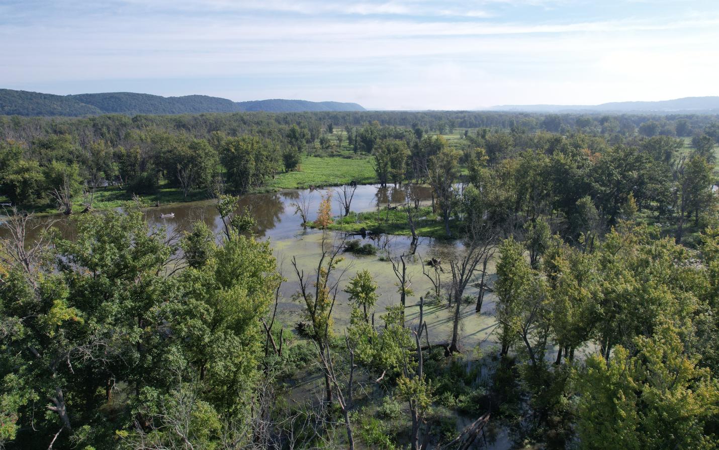
Mississippi Valley Conservancy’s publicly accessible land in northern Grant County also includes the Conservancy-owned Boscobel Bluffs State Natural Area just five miles to the east. Abbie Church, conservation director with the Conservancy, said that Woodman Floodplain provides exceptionally diverse wetlands and floodplain forest, southern sedge meadow, emergent marsh and wild rice marsh. The riverway was designated by the Ramsar Convention as a “wetland of international importance”, the second largest such site in Wisconsin. In addition to the riverway boundary, she added, the site is within three other priority areas: the Conservancy’s Wisconsin River priority area, the Lower Wisconsin River Important Bird Area (a global initiative administered by the Audubon Society) and the Lower Wisconsin Bluffs and Floodplain Conservation Opportunity Area (a priority area designated as of continental significance according the Wisconsin Wildlife Action Plan).
The property is adjacent to 1,198 acres of the Wisconsin DNR’s Lower Wisconsin River State Wildlife Area and Woodman Lake Sand Prairie and Dead Lake State Natural Area. The acquisition of Woodman Floodplain forms a nearly 1,400-acre complex of publicly accessible wildlife habitat. Cupp noted that the designated boundaries of the riverway include about 100,000 acres along its 92-acre length from below the dam at Prairie du Sac to Prairie du Chien of which about half are so far protected by public ownership.
Carol Abrahamzon, executive director at the Conservancy, said protecting large blocks of contiguous habitat is one of the most effective means of ensuring species and habitat resilience in a changing climate. “We couldn’t do this work or make such acquisitions without the ongoing support our nonprofit organization receives from private donations and memberships,” she said. The anonymous party who purchased the property to take it off the market said that it was good luck for her to learn it was for sale and that it fit with her passion “for saving every inch we can.” The Conservancy, in turn, intends to transfer the land to the Wisconsin DNR, subject to a conservation easement to restrict future land use for the benefit of the wildlife habitat and natural communities.
According to Eric Epstein, a retired DNR ecologist, the site is one of the best-known representations of southern wild rice marshes in Wisconsin that hasn’t been significantly altered from its natural state. With this acquisition the site now becomes one of the only such marshes that is protected in Wisconsin. Along with the robust southern wild rice marshes, the southern sedge meadow on the property is also exceptionally diverse with bluejoint grass, cattail sedge, lake sedge, swamp milkweed, joe pye weed, and an abundance of other species, according to a site inventory. The property also includes fish and wildlife species such as the state endangered starhead topminnow, beaver, white-tailed deer, the species of special concern red-shouldered hawk, trumpeter swan, green heron, sedge wren, red-headed woodpecker, great blue heron, sandhill crane, state threatened cerulean warbler, and special concern prothonotary warbler.
The Conservancy’s acquisition fits with goals within Wisconsin’s State Wildlife Action Plan (2015), the Grant County Comprehensive Plan (2009), the Town of Woodman Comprehensive Plan (2009), the Grant County Land and Water Resource Management Plan (2018), and the Lower Wisconsin State Riverway Master Plan (2016) which all prioritize the protection of wetlands and floodplains.
According to Gretchen Pfeiffer, president of the Conservancy, the Woodman Floodplain State Natural Area will now provide an exceptional scenic resource for the local community, including paddlers and anglers, in perpetuity. The property is visible from the Wisconsin River and Woodman Lake, from the surrounding DNR-owned land and habitat, and from adjoining and nearby properties.