Woodman Floodplain State Natural Area
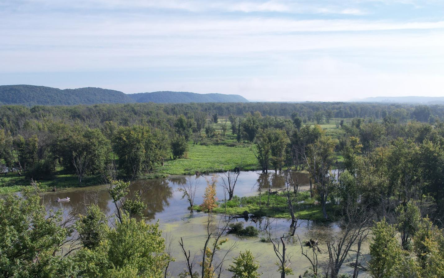
Woodman Floodplain State Natural Area (SNA) consists of nearly 200 acres of floodplain forest, marsh and meadow along the Wisconsin River in Grant County, Wisconsin. It was acquired and permanently protected by Mississippi Valley Conservancy in 2024. With this acquisition, the Conservancy has guaranteed public access and protection to a part of the Lower Wisconsin State Riverway – a landmark project in the state’s land conservation history. The property is open to the public for hiking, hunting, fishing, snow-shoeing, canoeing, kayaking and cross-country skiing. The nearest boat landing for parking and access is on the adjacent Wisconsin DNR Woodman Unit of the Lower Wisconsin State Riverway.
Woodman Floodplain SNA consists of exceptionally diverse wetlands and floodplain forest, southern sedge meadow, emergent marsh and wild rice marsh. The riverway was designated by the Ramsar Convention as a “wetland of international importance”, the second largest such site in Wisconsin. In addition to the riverway boundary, the site is within three other priority areas: the Conservancy’s Wisconsin River priority area, the Lower Wisconsin River Important Bird Area (a global initiative administered by the Audubon Society) and the Lower Wisconsin Bluffs and Floodplain Conservation Opportunity Area (a priority area designated as of continental significance according to the Wisconsin Wildlife Action Plan).
The property is adjacent to 1,198 acres of the Wisconsin DNR’s Lower Wisconsin River State Wildlife Area and Woodman Lake Sand Prairie and Dead Lake State Natural Area. The acquisition of Woodman Floodplain forms a nearly 1,400-acre complex of public wildlife habitat. The designated boundaries of the riverway include about 100,000 acres along its 92-acre length from below the dam at Prairie du Sac to Prairie du Chien of which about half are so far protected by public ownership.
The site is one of the best-known representations of southern wild rice marshes in Wisconsin that hasn’t been significantly altered from its natural state. With this acquisition the site now becomes one of the only such marshes that is protected in Wisconsin. Along with the robust southern wild rice marshes, the southern sedge meadow on the property is also exceptionally diverse with bluejoint grass, cattail sedge, lake sedge, swamp milkweed, joe pye weed, and an abundance of other species, according to a site inventory. The property also includes fish and wildlife species such as the state endangered starhead topminnow, beaver, white-tailed deer, the species of special concern red-shouldered hawk, trumpeter swan, green heron, sedge wren, red-headed woodpecker, great blue heron, sandhill crane, state threatened cerulean warbler, and special concern prothonotary warbler.
The Conservancy’s acquisition of this property fits with goals within Wisconsin’s State Wildlife Action Plan (2015), the Grant County Comprehensive Plan (2009), the Town of Woodman Comprehensive Plan (2009), the Grant County Land and Water Resource Management Plan (2018), and the Lower Wisconsin State Riverway Master Plan (2016) which all prioritize the protection of wetlands and floodplains.
Partners in the project include the Wisconsin Department of Natural Resources with funding through the Knowles-Nelson Stewardship Program and the National Wild Turkey Federation (NWTF) Hunting Heritage Super Fund, along with an in-kind donation by the seller who has asked to remain anonymous. Thanks to support from these partners and from supporters of the Conservancy, the Woodman Floodplain State Natural Area will continue to provide an exceptional scenic resource for the local community, including paddlers and anglers, in perpetuity. The property is visible from the Wisconsin River and Woodman Lake, from the surrounding DNR-owned land and habitat, and from adjoining and nearby properties.
Public access
Bikes and dogs are NOT allowed. Visitors must follow our recreational use policy as well as all federal and state laws and local ordinances. When visiting protected lands, please avoid trespassing onto the lands of neighboring property owners.
From La Crosse follow WI Hwy 35 south to US Hwy 14 east. At the round-about head east on US Hwy 14 and continue for 45 miles to Readstown. At Readstown, turn right on US Hwy 61 and continue for 25.4 miles into the city of Boscobel and turn right onto WI Hwy 133. Proceed 5.9 miles to Woodman Lake Lane and turn right. Proceed ¾ mile to DNR parking area with boat launch which are on DNR land which is adjacent to Woodman Floodplain State Natural Area. The address of the property is 16464 Woodman Lake Lane, Woodman, WI.
GPS coordinates: 43°06’24”N 90°47’03”W